I may not have a 401(k) or a pension, but glad I don't have to commute today!
Chicago Tribune | Incoming storm's greatest snow risk: 6-10 hours Friday night
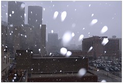
Friday night's fast moving storm presents forecasters with real challenges while threatening January's first significant Chicago snowfall. Above-freezing temperatures as precipitation begins late Friday afternoon are likely to promote rain initially. But, it's a situation likely to change quickly as the atmosphere cools. The area may ultimately be subjected to as many as 10 hours of snowfall. Since temperatures in the lower atmosphere will hover at or just above freezing during the storm's “snow phase”, a very wet breed of snowflake is likely. Flakes such as this often adhere to others as they fall. The combined flakes which result can grow quite large. Computer projected storm “dynamics”--those aspects of the system which create lift and cool moist air to produce clouds and precipitation-- appear likely to be strongest for nearly 6 hours--commencing near 6 p.m. and continuing just past midnight (though flakes may continue falling until 3 or 4 a.m.). A series of computer precipitation projections averages 0.33“ over the city, enough to produce 2-4” of snow.
